
Features 横浜市避難ナビ
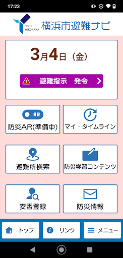
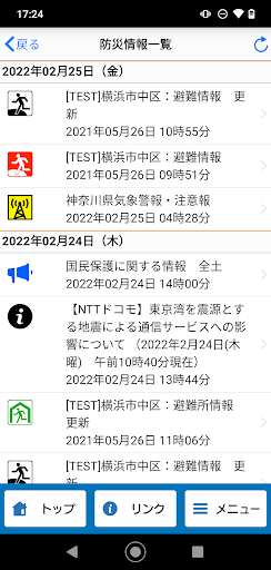
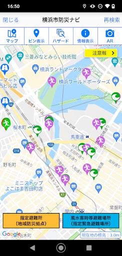
"Yokohama City Evacuation Navi" is a disaster prevention app provided by Yokohama City.We provide integrated support for evacuation behavior during disasters from normal times to disasters.・ You can check hazard maps and evacuation sites.・ You can create a My Timeline, which is an evacuation action plan for each person in the event of a storm or flood.・ In the event of a disaster, you will be notified in conjunction with the My Timeline that created evacuation information, and you can check the status of evacuation areas.・ "Yokohama City Evacuation Navi" can be used not only in Yokohama City but all over the country.[Main functions]・ Automatic search for evacuation shelters around your current location・ Hazard map display of sediment-related disaster warning areas, inundation areas, etc.・ Display of disaster prevention information and danger information at your current location・ My timeline creation function・ AR camera function, evacuation compass function・ Offline function・ Push notification of evacuation information in the event of a disaster・ Confirmation of the establishment status of evacuation areas in the event of a disaster・ Safety registration and safety confirmation・ Disaster prevention learning content
Gaming Features
Enjoy immersive gaming experience with various game modes.
Camera Features
Advanced camera features with editing capabilities.
Learning Tools
Enhance your learning experience with interactive features.
See the 横浜市避難ナビ in Action
Get the App Today
Available for Android 8.0 and above